

Adventure Consults reports that the Giraffe Conservation Foundation (GCF) and Uganda Wildlife Authority (UWA) recently undertook the largest ever GPS satellite tagging of giraffe to better understand their spatial movements and habitat use in the wilds of northern Uganda.
Twenty-five newly designed and tested solar powered GPS satellite units were fitted to giraffe in Kidepo Valley and Murchison Falls national parks. These units are small (the size of three matchboxes), less obtrusive and have better technology and battery capacity than their predecessors.
 While being fitted with units, the veterinary team collected important biodata from each giraffe, including measurements, genetic and blood samples and skin-disease assessment. They were also treated with medication to help with current and potential future health problems. While in the parks, the veterinary team also removed snares from a giraffe and a young elephant — making this an all-round conservation success.
The exercise is part of a new and exciting Africa-wide initiative named Twiga Tracker (twiga is Swahili for giraffe). Twiga Tracker is a collaboration between GCF, the Smithsonian Conservation Biology Institute, and the San Diego Zoo Global & Wildlife Conservation Alliance that aims to better understand spatial movements of all four giraffe species and their use of habitat. Using science as a base to support long-term giraffe conservation, Twiga Tracker plans to study more than 250 giraffe across their range.
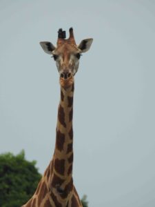
Giraffe face many threats in the wild, such as large-scale habitat loss, population fragmentation and degradation of their preferred habitat, as well as disease and poaching. These threats were highlighted by the IUCN SSC Giraffe & Okapi Specialist Group when giraffe were upgraded to “Vulnerable to extinction” on the IUCN Red List in December 2016.
Nubian giraffe numbers have dropped by more than 95% in the past 30 years, and it’s critical to better understand their 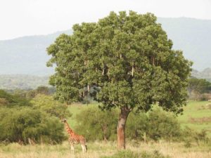 needs now to help protect the species. While technology can help conservation, it’s also important to have on-the-ground, field-based monitoring to understand the full picture. GCF, UWA and other partners like Dartmouth College in the U.S. have undertaken this task for the past four years and the results are helping conservation authorities make informed management decisions.
As part of the continent-wide Twiga Tracker initiative, the recent GPS satellite tagging of giraffe in Uganda will allow the Adventure Consults team to monitor the movements and habitat use of tagged giraffe in these critical refuges over the next few years.


About The Author: Jenna Farber
More posts by Jenna Farber