One year after Seychelles legally designated 30 percent of its territorial waters as marine protected areas 10 years ahead of international targets, efforts are now underway to develop a legal and strategic framework as well as a management plan for each of these sites.
The principal secretary for the environment, Alain Decomarmond, said each site will have a plan that dictates what type of activities can be done as per the Blue Economy Strategy. The plans will also examine conservation issues, enforcement and research that can be done.
Decomarmond spoke last Friday at the presentation of a series of canvas printed materials to showcase the historic marine designation in which the island nation tripled the goal of having 10 percent of its marine area protected by 2030. The UN Convention of Biological Diversity Target 11 and the UN Sustainable Development Goal SDG-14 both call for 10 percent marine protection by 2030.
“We are at the implementation stage. The plan before COVID was to start implementation in 2021, but we have been delayed. But we have had many virtual consultations and gradually work on the framework has started,” explained Decomarmond.
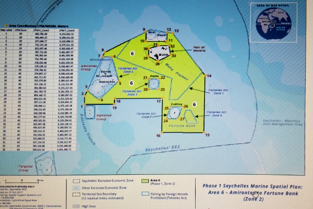
The principal secretary added that the remaining 70 percent of Seychelles’ waters are also being looked at under the Marine Spatial Plan which will work as a land-use plan and will look at “what type of activities can happen at different areas.”
“Thirty percent declaration is a big thing for Seychelles and we must carry that with us everywhere we go. It’s a big achievement globally for Seychelles and was part of the commitment we made many years ago. Seychelles achieved it in a rather short time compared to many countries and I think it is something we should all be proud of,” said the Minister for Agriculture, Environment and Climate Change.
Flavien Joubert appealed to more young people to do like James Dupres – the creator of the canvases – to support environmental initiatives. Dupres told journalists that his work is a combination of colours and shapes of the ocean.
“These represent Seychelles’ ocean, the Indian Ocean and also the elements that represent the underwater biodiversity, and when we were doing the project, we were thinking of the elements and colours that will come out very well on digital aspect and print as well, so we used the parrotfish, octopus, whale shark, we used a combination of these,” explained Dupres.
The 30 percent represents 13 new areas now protected under the National Parks and Nature Conservancy Act, totalling 410,000 square kilometres of the island nation’s Exclusive Economic Zone (EEZ) of 1.4 million square kilometres.
 |
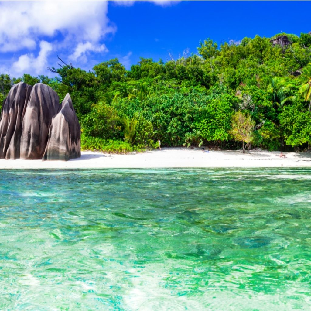
| Seychelles legally designated 30 percent of its territorial waters as marine protected areas 10 years ahead of international targets. (Salifa Karapetyan, Seychelles News Agency) Photo License: CC-BY |
These new areas include the waters surrounding the Aldabra group, marine areas in the Amirantes including D’Arros to Poivre, and the South of Amirantes and Bird Island, one of the only two sand cays in the inner island group.
The rest which falls within the Amirantes to Fortune Bank are of medium biodiversity and designated for sustainable use where activities vital to Seychelles’ economy will continue to operate but will be managed under new sustainability regulations.
The Seychelles Marine Spatial Plan is the first comprehensive, large-scale Marine Spatial Plan in the western Indian Ocean, one of the first for a Small Island Developing State, and the largest Marine Spatial Plan in the world, after Norway.
It is a government-led initiative with the support of the Nature Conservancy Trust, following the award-winning debt-for-nature swap, which was formalised through the creation of the Seychelles Conservation and Climate Adaptation Trust in 2016.

About The Author: David DiGregorio
More posts by David DiGregorio